Home
Green Wedges
Green Wedges
We consulted on a draft local plan from November 2022 to January 2023 that referred to Green Wedges.
We suggested possible policy and indicated potential proposed boundary lines on maps. We are now consulting further on revised proposed:
- Policy Wording, and
- Green Wedge Boundaries
In considering these we would encourage you to look at the previous consultation and to consider Green Wedge policy and boundaries in the context of the full Draft East Devon Local Plan.
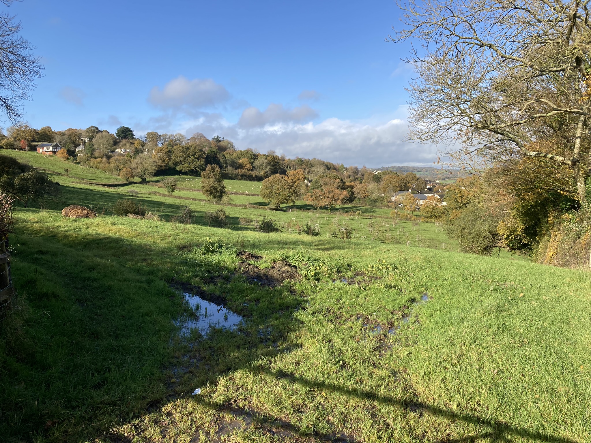
The idea behind Green Wedges is that they identify areas between settlements (typically towns and villages) that help define and establish the individual character and separation of those settlements.
The concern is that if these 'gaps' start to be filled-in with built development or, more starkly, are completely filled-in with development, it could result in nearby (but separate) settlements progressively or completely merging into a single built-up mass and losing their separate identities.
The proposed Green Wedge at Colyton
We have drawn Green Wedges to typically align with the built-up edges of settlements, the point where the urban and built form of development transitions in to countryside and rural areas.
We recognise that there is not always a very clear, obvious and stark dividing line between urban and rural places and as such there can be some judgement calls on exactly where boundaries should be drawn.
The division between urban and rural helps establish a point at which intrinsic settlement separation can be seen to start to occur.
This is the point at which it may be understood or perceived that you are leaving one settlement, entering the countryside, then travelling through that countryside or open space, before entering a new and different settlement.
The Green Wedge boundaries are drawn to fill the most obvious and direct gaps between settlements, typically the closest parts.
They are, however, also drawn to wrap around some edges of settlements (especially town edges) in recognition that coalescence could ultimately occur through the creeping of development, or one-off big developments, that occur around outer Green Wedge edges, rather than just through their centre or core.
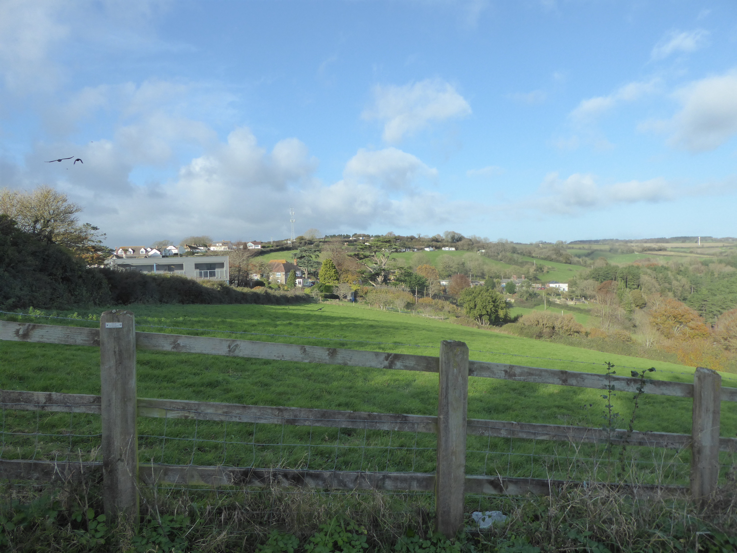 The proposed Green Wedge between Seaton and Beer
We have drafted policy wording for the Green Wedges, as set out below.
We welcome your views as to whether the policy wording is appropriate:
Policy – Green Wedges
Green Wedges are defined on the Policies Map and are identified as areas between settlements where constraints on development are essential to prevent physical or visual coalescence and/or maintaining the character and identity of those settlements or a sense of intrinsic separation.
Development will not be permitted in defined areas if that development would create in its own right or add to existing sporadic or isolated development or damage the individual identity of a settlement or could lead to, encourage or start to lead to actual or potential for settlement coalescence.
The maps that follow show the areas of land that are proposed to be designated as Green Wedges.
These are areas that are identified as important in terms of separating settlements that are close together.
It is considered that inappropriate (non-policy compliant) development in these areas would lead to the settlements either merging, moving in this direction or there being a perception of moving towards merging together and thus losing their distinctive separate identities.
There is therefore a restrictive policy approach, as reinforced by other restrictive policies in the local plan, in respect of what may be built in these areas.
We include maps on the proposed Green Wedges in the remainder of this report and we would welcome your views on whether you think we have shown appropriate boundaries.
If you think that different boundaries would be more appropriate, please tell us where they should go and why.
The proposed Green Wedge at Whimple
The main purpose of the Green Wedges is to protect the undeveloped land between settlements to stop them merging and to protect their separate characters.
However, a green wedge designation is not designed to prevent all development from taking place and some may still be necessary to meet local housing and employment needs.
There are some potential development sites (as set out in the consultation draft local plan) on the edges of settlements but within the Green Wedges.
These sites have been assessed as potentially being appropriate as they would not in themselves lead to settlement coalescence or threaten the individual identity of settlements, however if these sites are built on this could change the undeveloped character of the area.
Maps of proposed Green Wedges
Land between Budleigh Salterton and Knowle
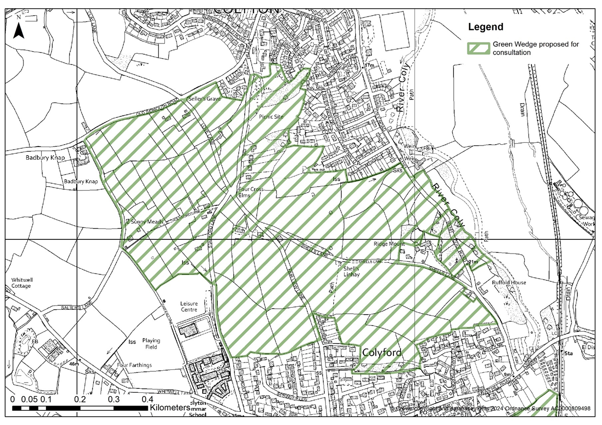
Land between Colyford and Colyton
Land between Seaton and Colyford
Land east of Exeter & the M5 and the villages of Sowton, Clyst Honiton & Topsham
Land between Exmouth and Lympstone
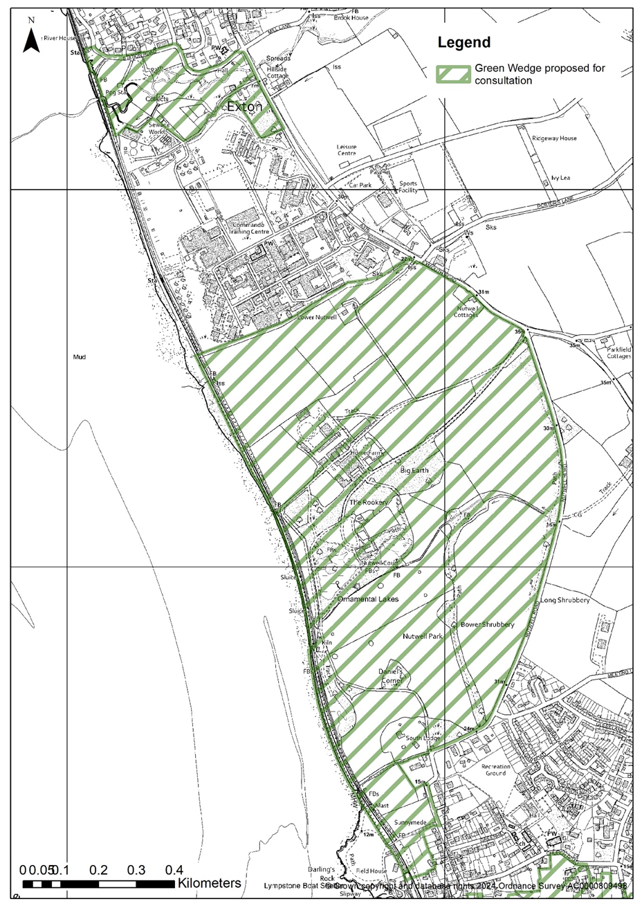
Land between Lympstone Commando and
Exton / Lympstone and Lympstone Commando
Land between Ottery St Mary and West Hill
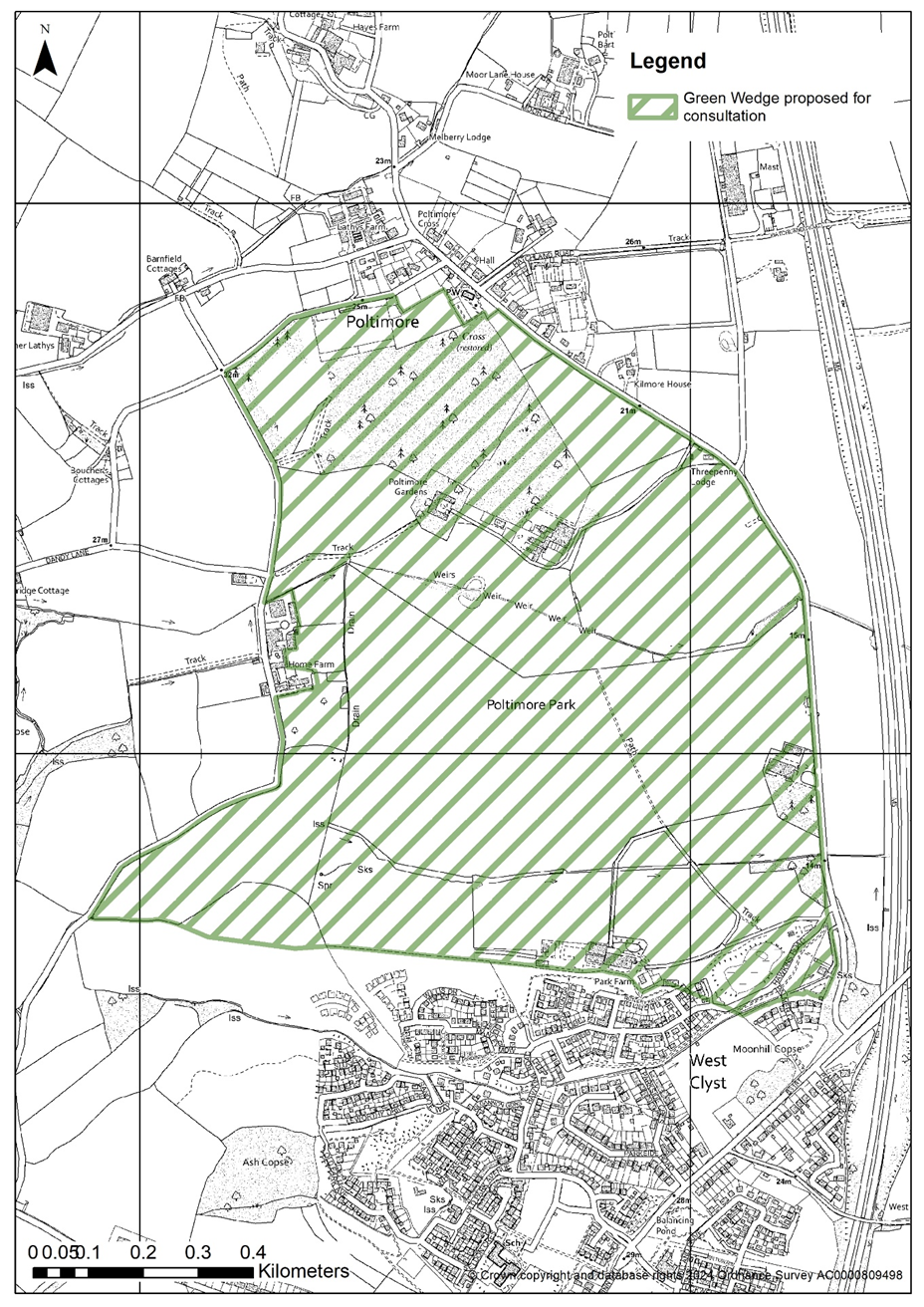
Land between Poltimore and Westclyst
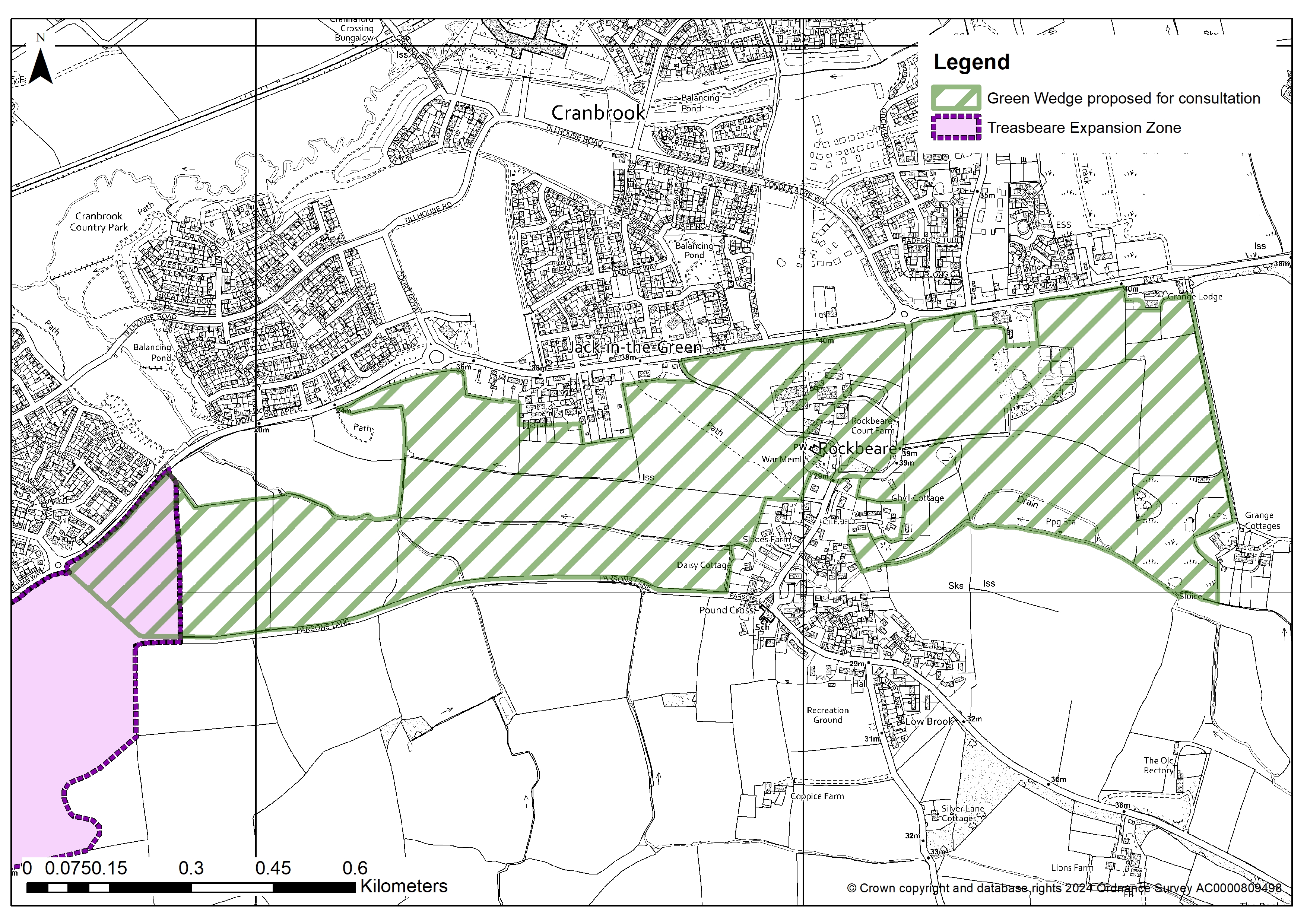
Land between Rockbeare and Cranbrook
Land between Sidbury and Sidford
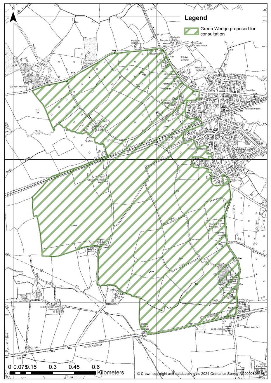
Land between Whimple and Cranbrook
Alternatively, you can view this responsive map
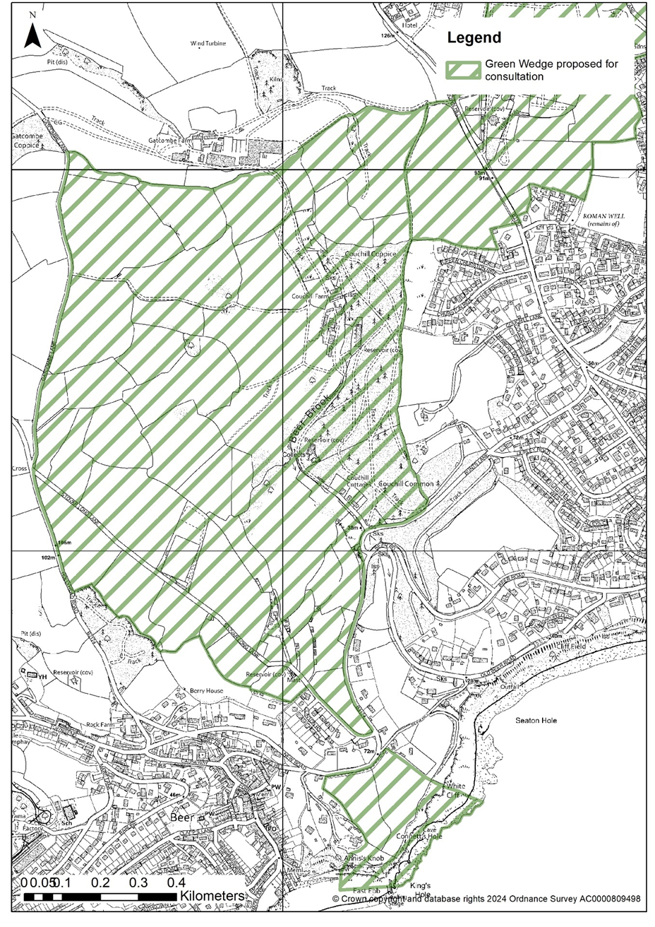
Land between Beer and Seaton
Land between Budleigh Salterton and Knowle
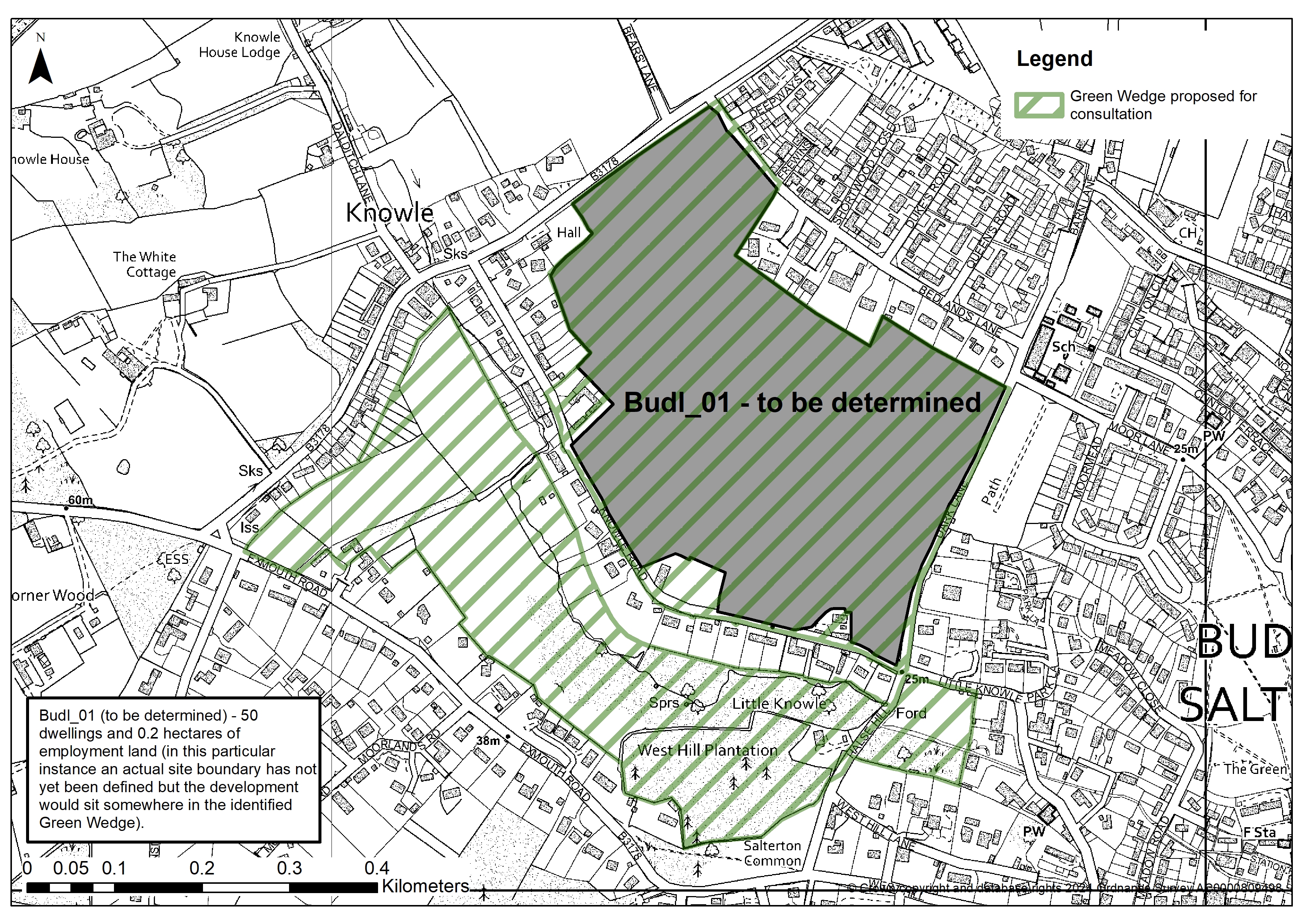
Budl_01 (to be determined) - 50 dwellings and 0.2 hectares of employment land (in this particular instance an actual site boundary has not yet been defined but the development would sit somewhere in the identified Green Wedge)
Land between Colyford and Colyton
Land between Seaton and Colyford
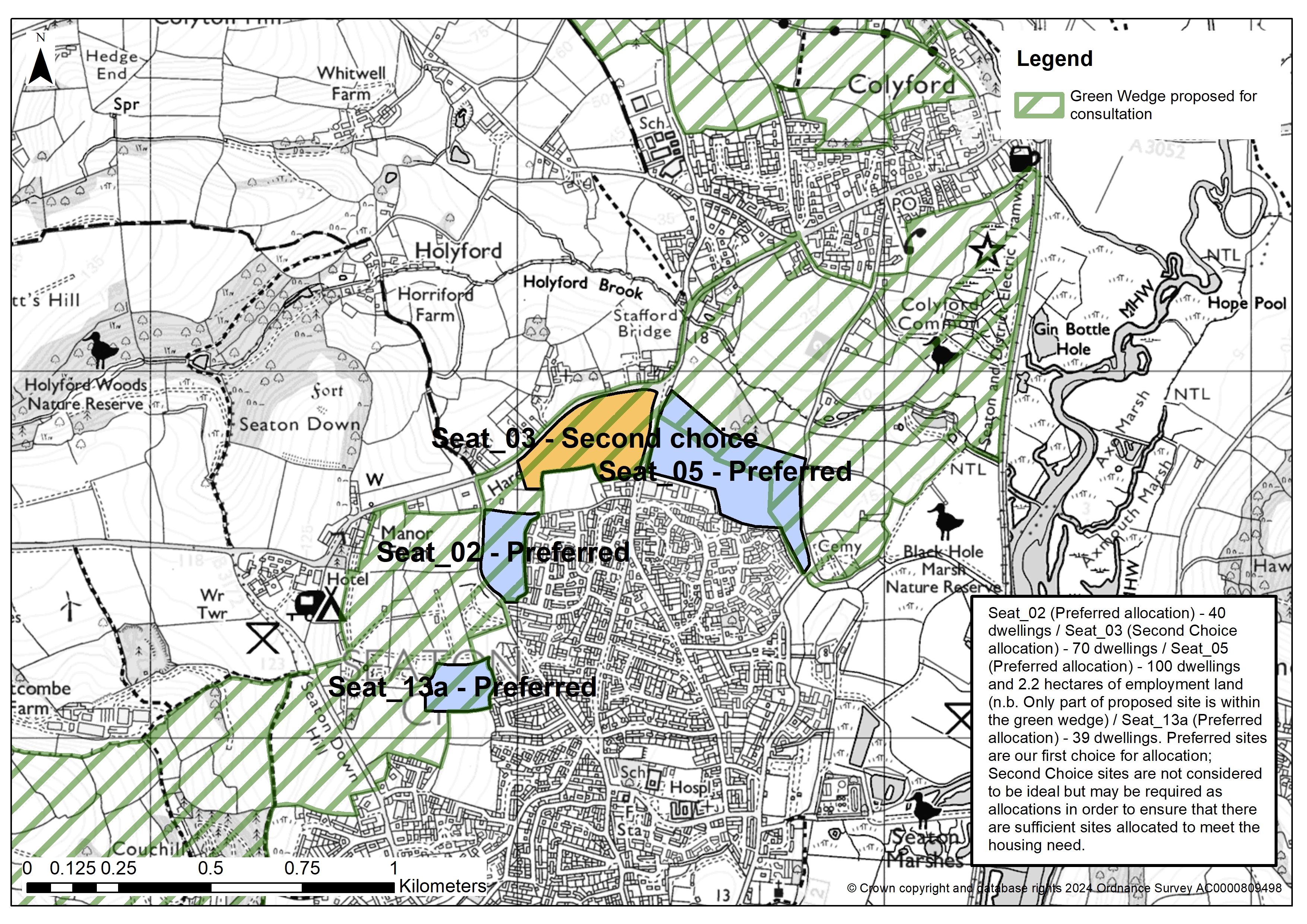
Seat_02 (Preferred allocation) - 40 dwellings
Seat_03 (Second Choice allocation) - 70 dwellings
Seat_05 (Preferred allocation) - 100 dwellings and 2.2 hectares of employment land (n.b. Only part of proposed site is within the green wedge)
Seat_13a (Preferred allocation) - 39 dwellings
Preferred sites are our first choice for allocation; Second Choice sites are not considered to be ideal but may be required as allocations in order to ensure that there are sufficient sites allocated to meet the housing need
Land east of Exeter & the M5 and the villages of Sowton, Clyst Honiton & Topsham
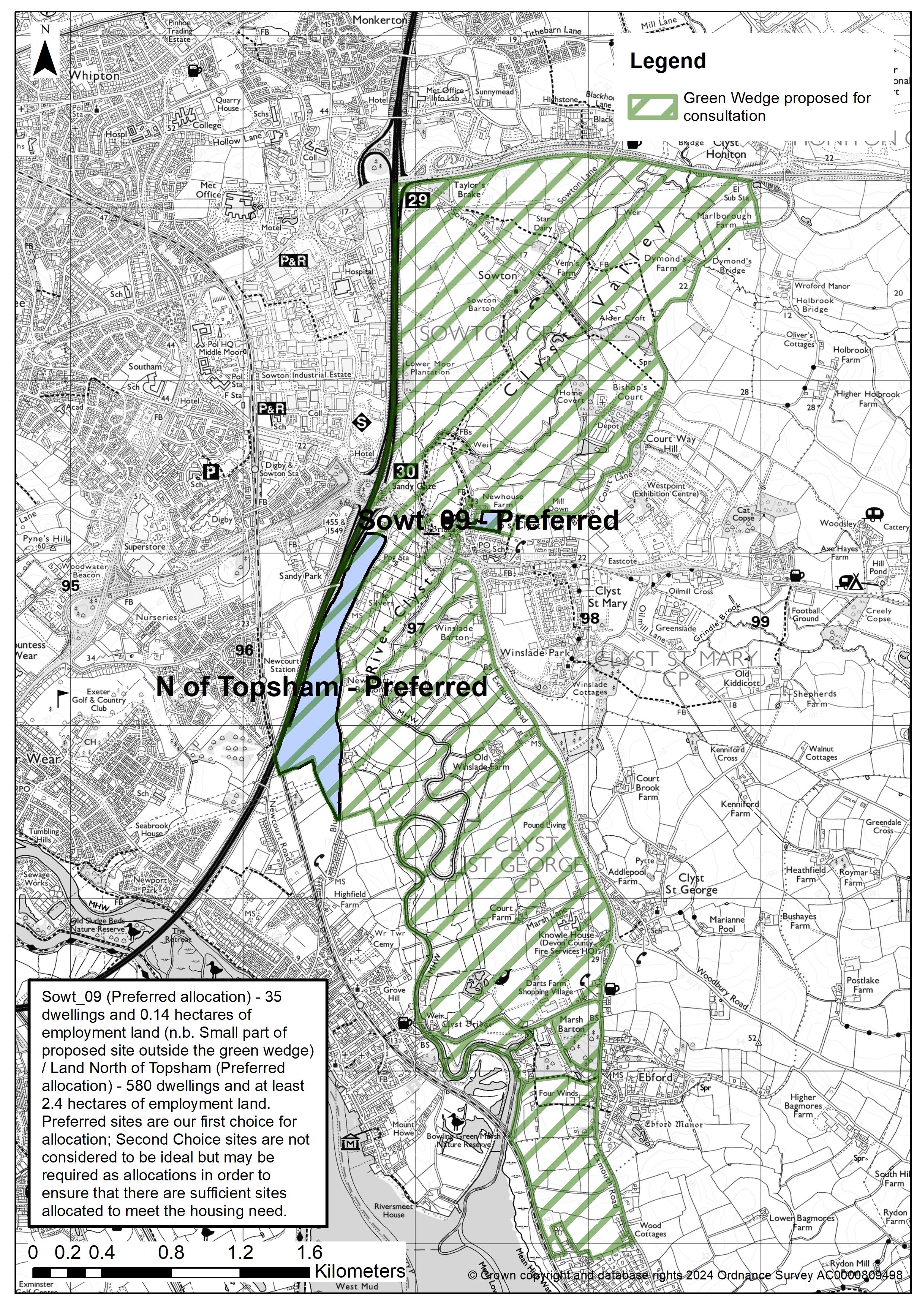
Sowt_09 (Preferred allocation) - 35 dwellings and 0.14 hectares of employment land (n.b. Small part of proposed site outside the green wedge)
Land North of Topsham (Preferred allocation) - 580 dwellings and at least 2.4 hectares of employment land
Preferred sites are our first choice for allocation; Second Choice sites are not considered to be ideal but may be required as allocations in order to ensure that there are sufficient sites allocated to meet the housing need
Land between Exmouth and Lympstone
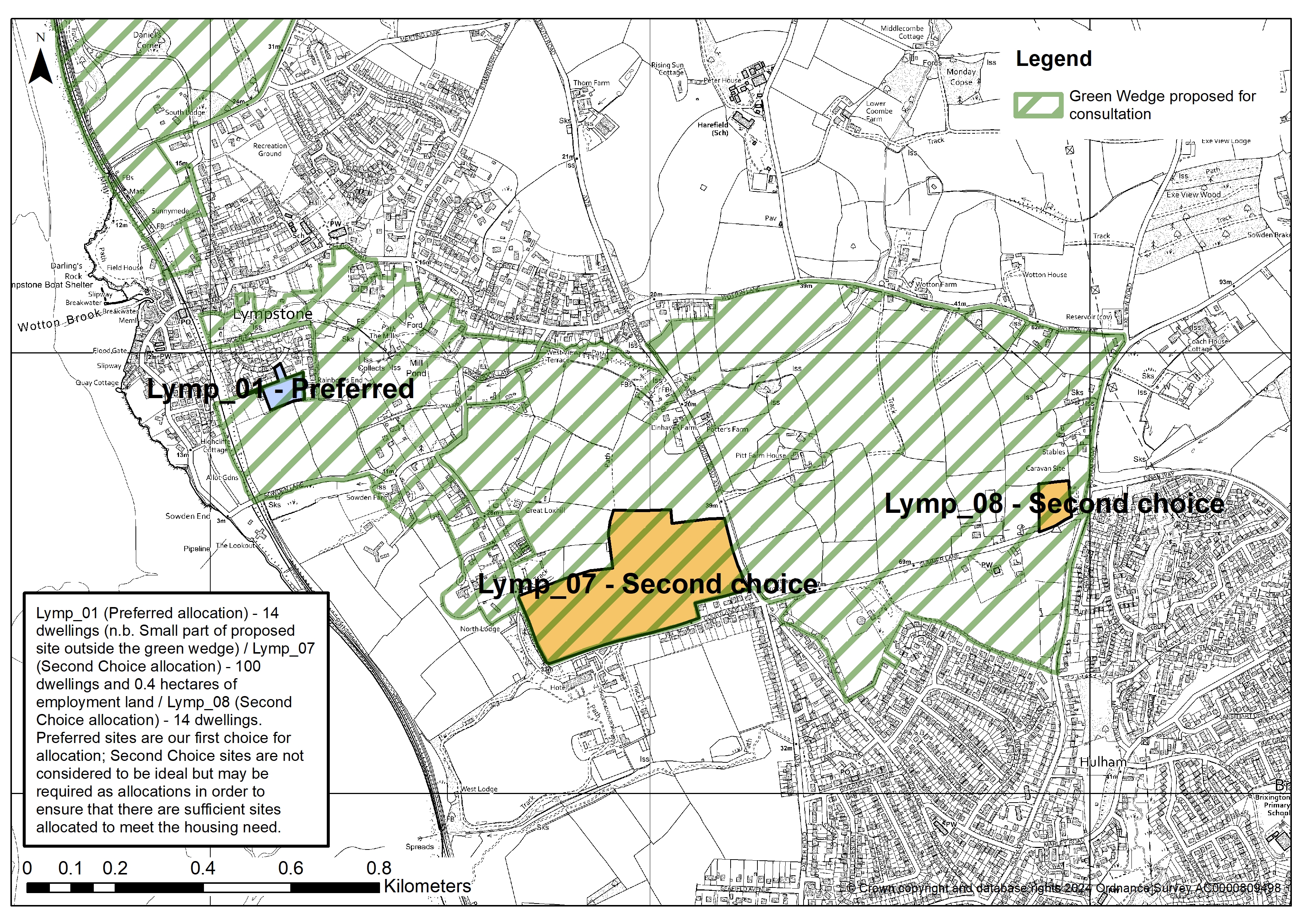
Lymp_01 (Preferred allocation) - 14 dwellings (n.b. Small part of proposed site outside the green wedge)
Lymp_07 (Second Choice allocation) - 100 dwellings and 0.4 hectares of employment land
Lymp_08 (Second Choice allocation) - 14 dwellings
Preferred sites are our first choice for allocation; Second Choice sites are not considered to be ideal but may be required as allocations in order to ensure that there are sufficient sites allocated to meet the housing need
Land between Lympstone Commando and Exton / Lympstone and Lympstone Commando
Land between Ottery St Mary and West Hill
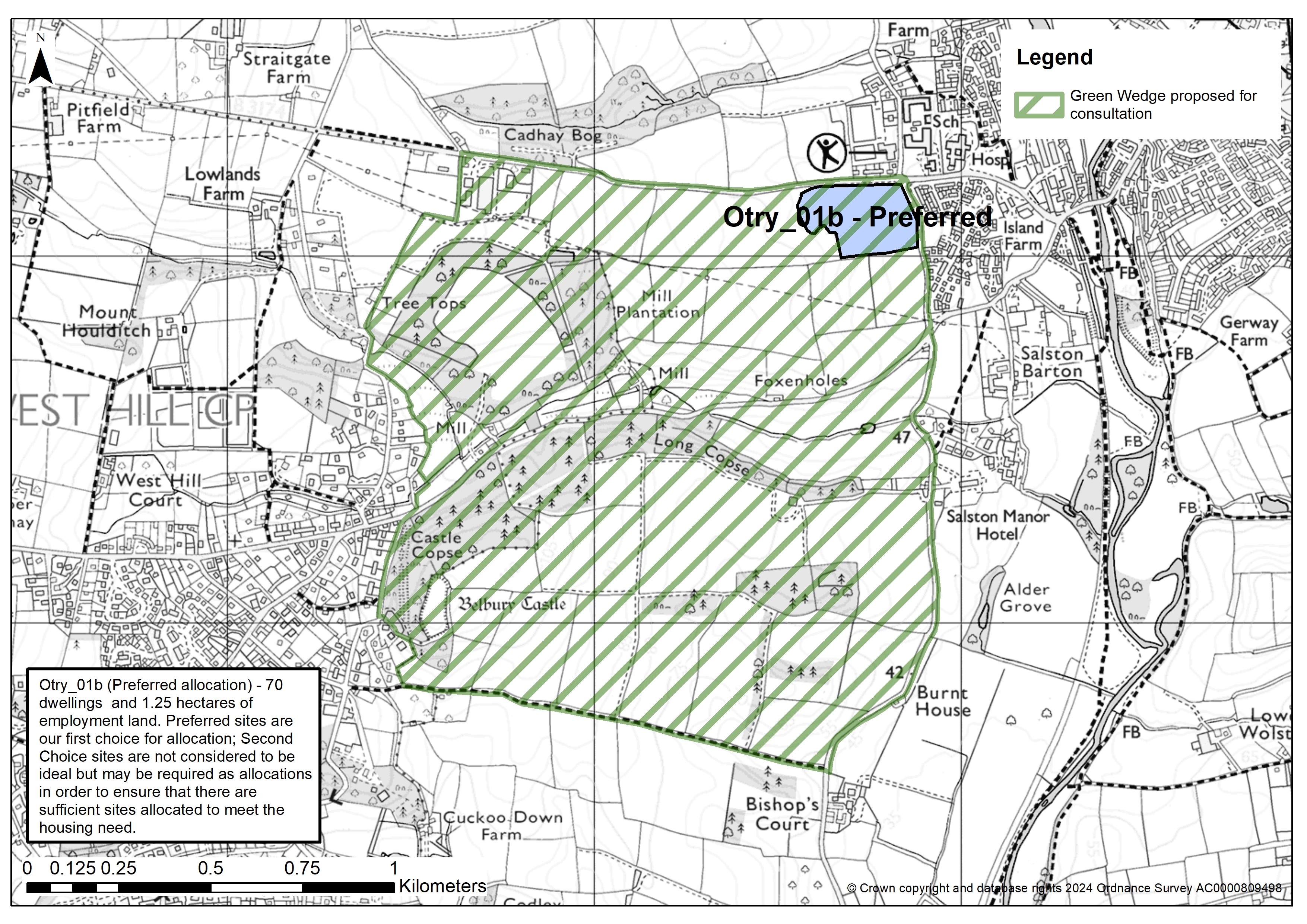
Otry_01b (Preferred allocation) - 70 dwellings and 1.25 hectares of employment land
Preferred sites are our first choice for allocation; Second Choice sites are not considered to be ideal but may be required as allocations in order to ensure that there are sufficient sites allocated to meet the housing need
Land between Poltimore and Westclyst
Land between Rockbeare and Cranbrook
Land between Sidbury and Sidford
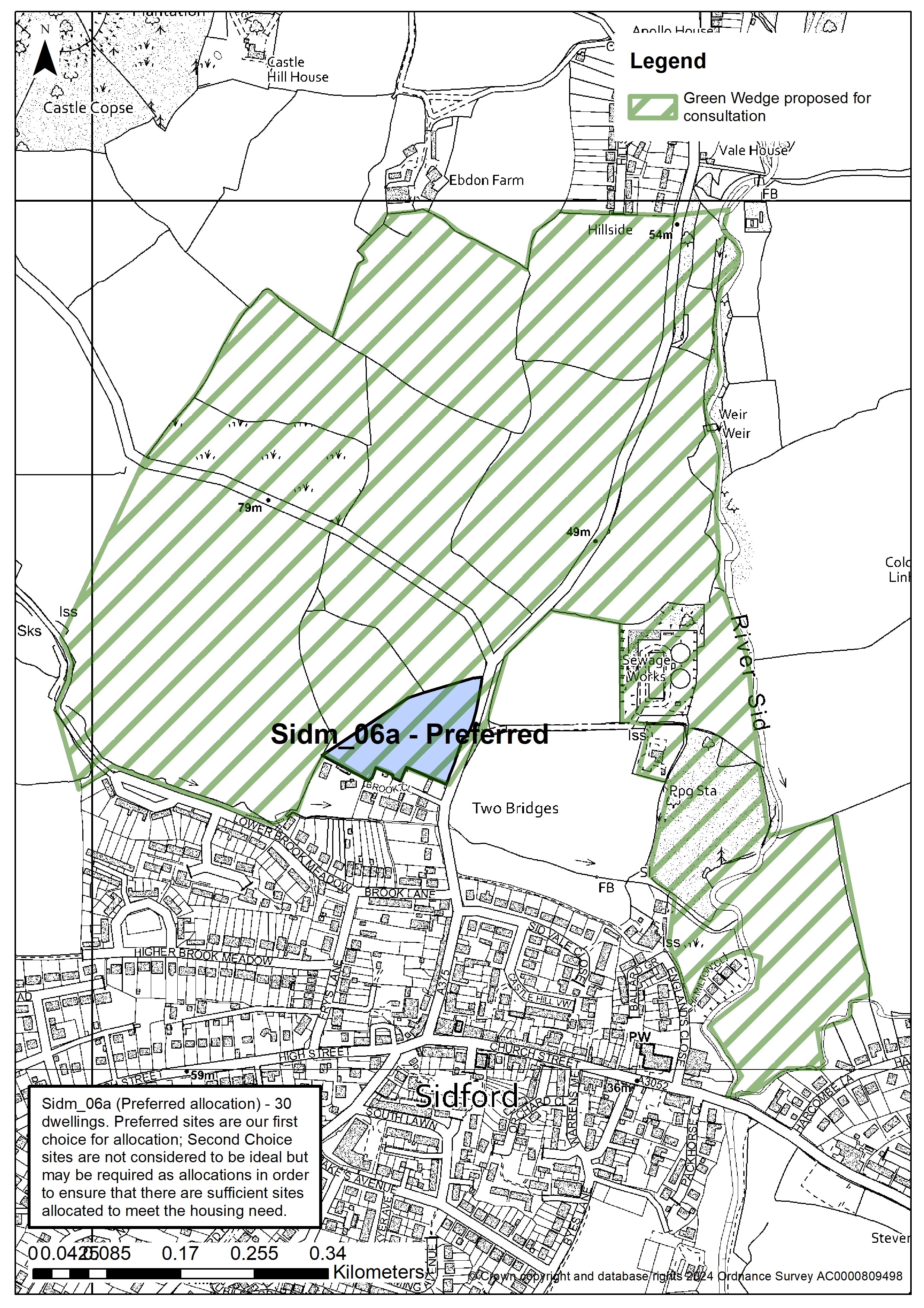
Sidm_06a (Preferred allocation) - 30 dwellings
Preferred sites are our first choice for allocation; Second Choice sites are not considered to be ideal but may be required as allocations in order to ensure that there are sufficient sites allocated to meet the housing need
Land between Whimple and Cranbrook
This engagement phase has finished

...